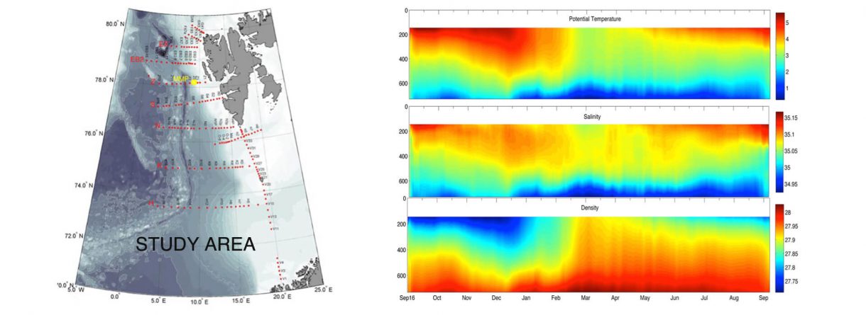
The main aim of this project was to investigate the relationship between the geostrophic surface currents, as calculated from the sea surface height measured by satellite altimeters, and the currents at other depth levels measured in situ along the West Spitsbergen Current (WSC) in the Arctic over 2000-2013. The relationship has also been analysed using a global high resolution ocean numerical model, in order to inform about the spatial and temporal variability of the relationship along the current pathway. This analysis has provided information on the vertical structure of the WSC along its pathway (70°-80°N).
The study also aimed at using the obtained relationship, combined with the modelled vertical structure of the WSC, to extend time series of the WSC to other seasons